The Map Metadata Page
The Map Metadata Editor Page of the PBS Editor.
Overview
The Map Metadata page is the dedicated editor within the PBS Editor for viewing and modifying all Map Metadata PBS data in your project. It provides a structured interface to inspect and edit every Map Metadata entry without needing to work directly with raw PBS files.
All default parameters defined by Essentials are presented in a clear and consistent layout, making it easy to understand and manage Map Metadata data at a glance. In addition, any fields introduced through plugins or custom extensions are automatically detected and displayed when present.
These extra properties are grouped under the Other Fields section, allowing the editor to remain clean and organized while still supporting extended functionality.
The screenshots below illustrate the general layout and structure of the Map Metadata editor. They serve as a visual guide to help you quickly locate sections and understand how information is organized within the interface.
Detailed explanations of individual parameters are provided in the sections that follow. For deeper technical insight or engine-level behavior, refer to the official documentation: Defining a Map's Metadata on the wiki.
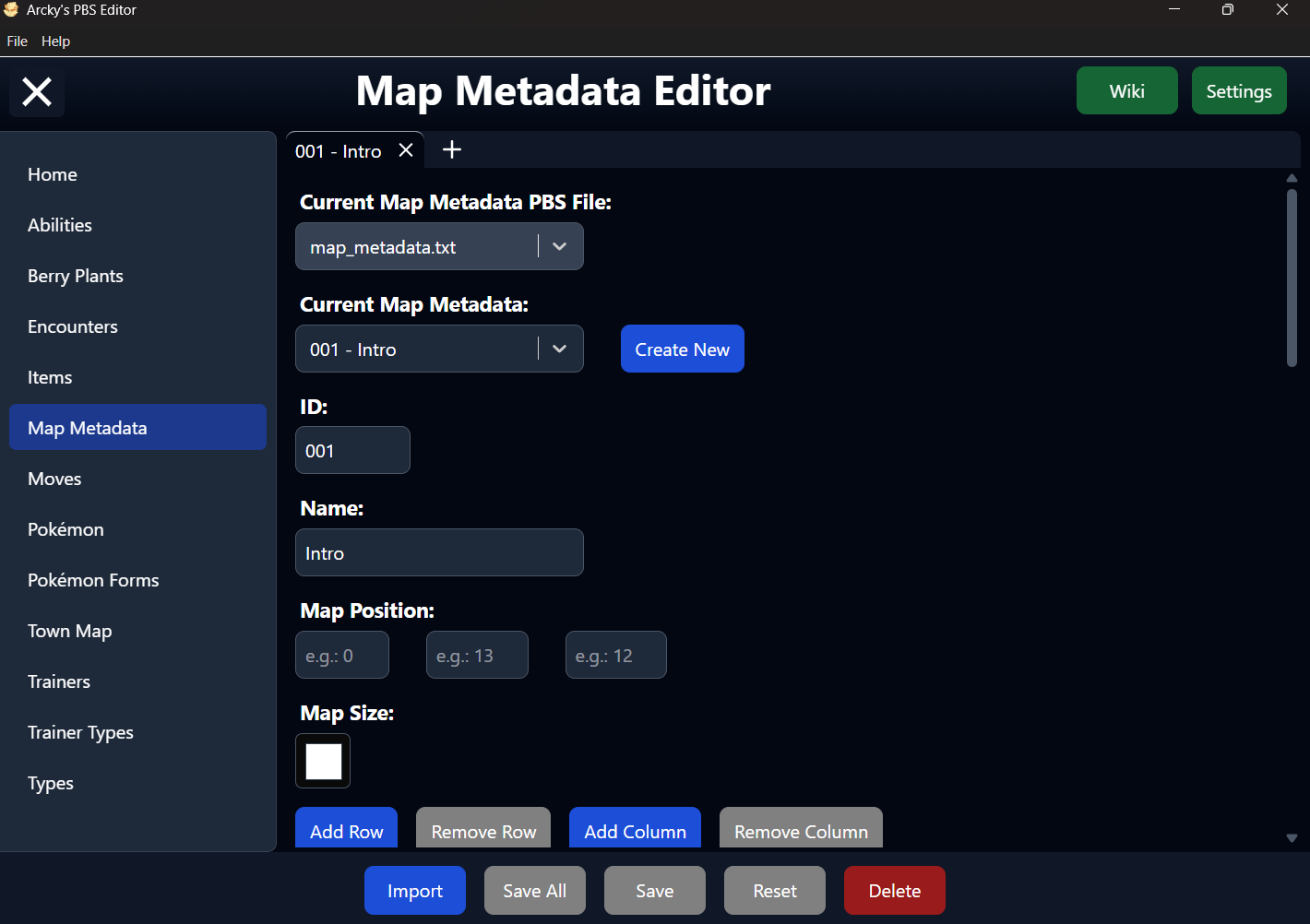
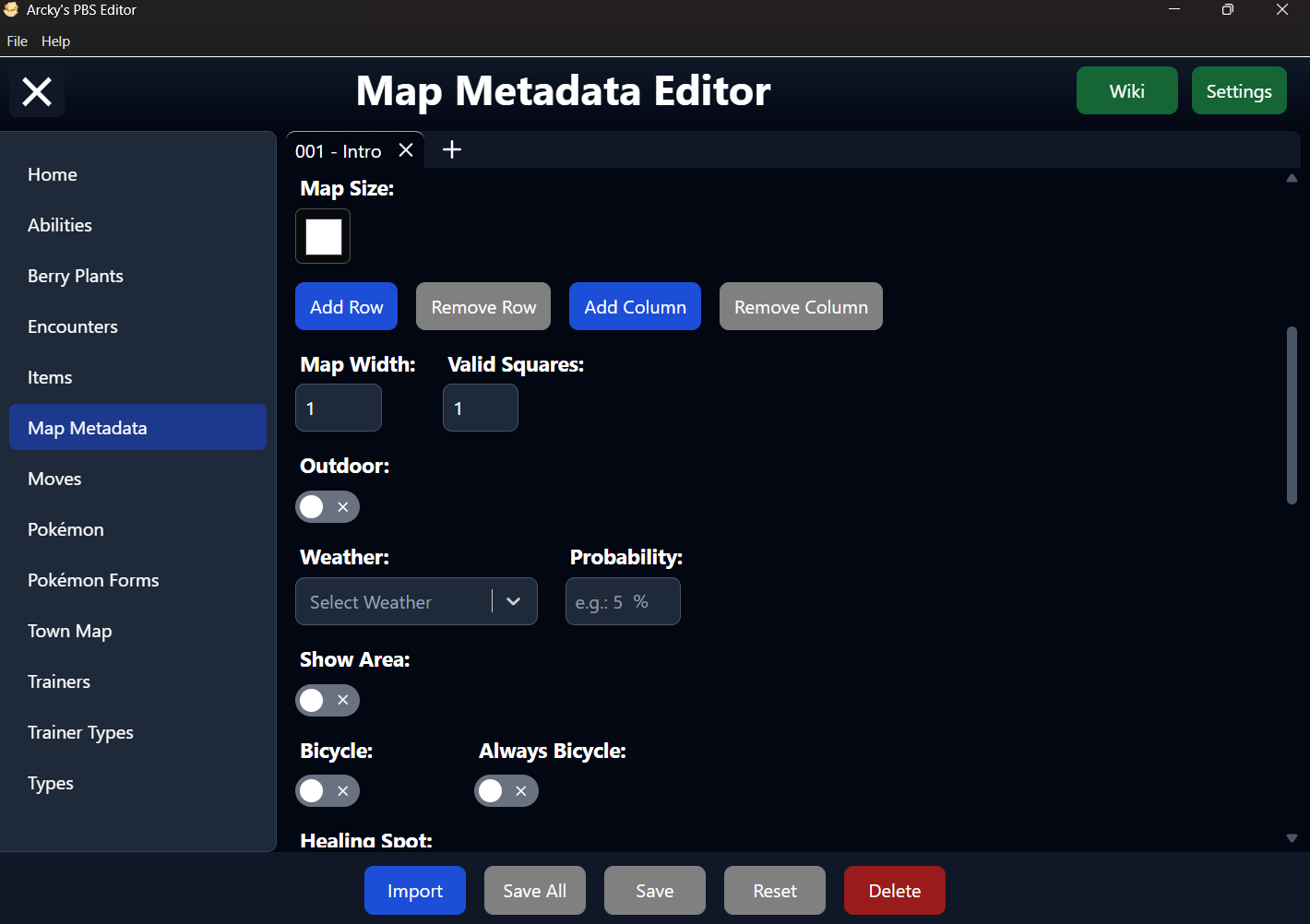
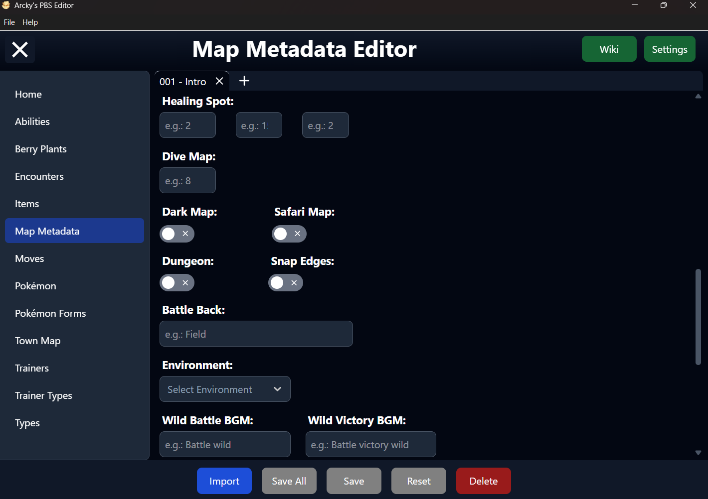
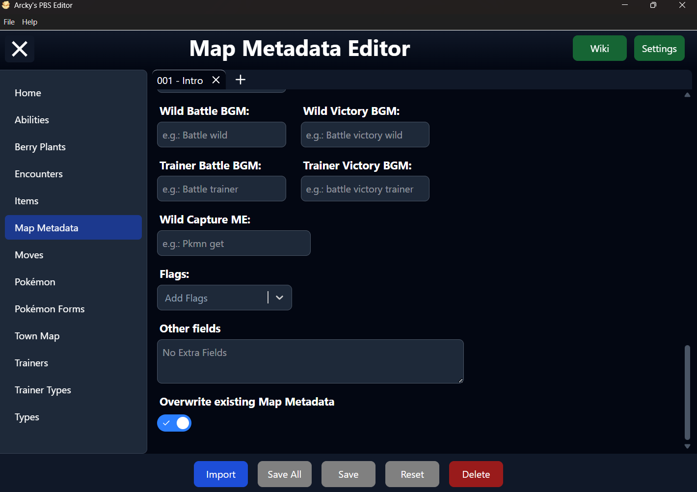
Wiki
Settings
Import Map Metadata
To Import one or more Map Metadata into the Editor, your data must be provided in a TSV (Tab-Separated Values) file.
The easiest way to create this format is by using Google Sheets, which allows you to quickly orignize your data and export it directly as a TSV file.
For reference, you can use the following example as a template for structuring your data correctly: TSV Berry Plants Example
Required Fields
Each Map Metadata entry must include the following required paramters:
- ID
- name
- mapPosition
If any of these fields are missing, the editor will skip the entry and report which required values are not present-helping you quickly identify and correct issues in your file.
File Selection
This dropdown allows you to choose between all available Map Metadata PBS files detected in your project.
The primary file is typically named map_metadata.txt, but the editor also supports additional files following the format map_metadata_xxx.txt.
The underscore (_) is required for these extra files to be recognized. Any text can follow it (e.g. map_metadata_custom.txt), but files without this naming pattern will not be detected as Map Metadata PBS files.
If only a single file is available, the dropdown will be automatically disabled, and that file will be selected by default.
Map Metadata Selection
This dropdown lists all available Map Metadata entries for the currently selected file, identified by their ID.
In the PBS file, these IDs are defined using the format [xxx]. For improved readability, the editor display them without brackets but with the matching Name Field value in the interface.
Despite this visual simplification, the brackets are still required in the actual PBS structure. When saving, the editor will automatically restore the correct [xxx] format, even though it is not shown within the editor itself.
ID
The ID servers as the internal identifier used by the engine to reference a Map Metadata. Each Map Metadata must have a unique ID to function correctly and should match the ID of an existing Game Map.
The ID is formatted as a 3-digit number (e.g. 002, 011). To help prevent errors, the editor will automatically pad the value with leading zeroes as you type.
Within the PBS file, the ID defines the start of a new Map Metadata entry and must always appear first in each block. This structure is handled automatically by the editor when saving, so no manual formatting is required.
Name
The Name defines the Name of the Game Map as shown to the player in-game.
This is the label used in the pause menu, save screen, load screen, show area feature, making it an important part of how the Map is presented to the player.
Default Value
The Name field is Required and must be defined for every single Game Map.
If left undefined, the RPG Maker map's name will be used instead.
Map Position
The Map Position defines the Region ID, X and Y positions of the Game Map.
This is what the Town Map needs to show the Player's Icon on the correct Position and Region Map in-game.
Default Value
The Map Position field is Required and must be defined for every single Game Map the player can enter on.
If left undefined, the Game might crash or show the wrong position on the Town Map for that Game Map
Map Size
The Map Size is split up in Map Width and Valid Squares and determines the size and shape of this map in region map squares. This metadata consists of 2 numbers:
- The width of the map, in squares. This can be 1.
- A string of 1s and 0s, which describe the shape of the map.
Luckily for you the Map Metadata Page provides a handy visual tool for you where you don't need to worry about filling in these 2 numbers, just use the buttons to add rows and colomns and click the squares to enable (1) or disable (0) them respectively.
Default Value
The Map Size fields are optional and should only be defined for bigger maps. No default value is assigned by the editor.
If left undefined, the Map's Map Size will be "1,1".
Outdoor
This toggle determines wether the Map is an outdoor map.
- On - The Map will be an outdoor map.
- Off - The Map wil be an indoor map.
Default Value
The Outdoor field is optional, but no default value is assigned by the editor.
If left undefined, the Map's will be set as an indoor map.
Weather and Probability
The Weather consists of two fields: the weather type and the probability (our of 100) of that weather occuring when the player enters this map.
Default Value
Weather and Probability fields are optional, but no default value is assigned by the editor.
If left undefined, the Map will have no weather.
Options
By default, the editor includes the following Weathers:
- Rain
- HeavyRain
- Storm
- Snow
- Blizzard
- Sandstorm
- Sun
- Fog
Show Area
This toggle determines wether a location signpost is being displayed at the top left of the screen when entering the Map.
- On - A location signpost will appear for the Map.
- Off - No location signpost will appear for the Map.
Default Value
The Show Area field is optional, but no default value is assinged by the editor.
If left undefined, the Map will have no location signpost shown.
Bicycle
This toggle determines wether player can use their Bicycle on this map.
- On - The Player can toggle their bicycle on the Map.
- Off - The Player cannot toggle their bicylce on the Map.
Default Value
The Bicylce field is optional, but no default value is assigned by the editor.
If left undefined, the player will only be able to toggle it's bicycle if the Map is an outdoor map.
Always Bicycle
This toggle determines wether the bicylce will be automatically mounted upon the Player entering the map.
- On - The Player's bicycle will automatically be mounted.
- Off - The Player's bicycle will not automatically be mounted.
Default Value
The Always Bicylce field is optional, but no default value is assigned by the editor.
If left undefined, the player's bicylce will not be automatically mounted upon entering the map.
Healing Spot
The Healing Spot defined the Game Map ID, X and Y positions of a particular tile in that map.
Default Value
The Healing Spot does not has a default value.